Wednesday, January 26, 2011

Great Slave Lake: Glimpses of the Landscape


By:  Tom

When preparing for a trip I rummage around for images of the area where I will be paddling and take advantage of Google Earth to fly over the area, trying to spot landing spots, prominent land features and potential hazards.  These visual reference sources help in getting mentally prepared for the conditions and can be very useful in navigation.  While this kind of visual due diligence removes some of the "surprise" factor in a trip, I've always felt more comfortable having some visual sense of the area I'm going to visit.  That information seems to enhance rather than detract from the appeal of the trip.

Below are some images of Great Slave Lake, the East Arm in particular.  (More images accessible here.) These pictures tell me that in some areas landing spots will be hard to find because of the cliffs.  From these photos and Google Earth it appears that there are few if any sandy beaches in the East Arm, even at the mouth of streams.  Camping sites will be on rock for the most part, which will affect how tents are staked down.  In many areas trees will be few in number and stunted, which means we won't be able to count on living windbreaks or handy branches in lieu of clotheslines.  Choice of campsite location will be critical on windy days, as we will have to rely on cliffs and other landforms to shield us from the wind, especially as nighttime temperature hit the upper 30s.

I don't see much evidence of showers, electrical outlets or coffee shops either.


.

Thursday, January 20, 2011

Escalating Commitments: Flights Booked

By:  Tom

A kayak camping trip involving two or more people is a series of escalating commitments.  They begin with minimal commitments to get together for coffee and chat about a possible venture.  As a trip comes together the commitments grow as the participants take on various planning tasks.  Perhaps the most important commitment comes when the group first puts in.  Here, they entrust their well-being for the duration of the paddling trip to the other participants and in turn make a commitment to watch out for the other participants.

Sarah and I made an major commitment last week when we booked our flights from Chicago to Yellowknife, NWT.  We are going on the same flight out to Yellowknife.  We'll leave Chicago about 2 p.m., change planes in Calgary, and then arrive in Yellowknife about 11 p.m. local time.  We'll return on the same flight from Yellowknife to Calgary, leaving at 6 a.m.  However, I am booked on a flight back to Chicago through Toronto, while Sarah was fortunate to find a direct flight from Calgary to Chicago.  We'll both arrive back in Chicago about 4 p.m.

There was a couple of days when I had booked my flight but Sarah was still investigating options.  I must confess to having a tinge of worry that she might reconsider making a commitment to a Great Slave Lake trip.  I even mentioned to my son that he could come along if Sarah opted out of the trip.  At 15 and with a strong self-identification as an "urban kid," the thought of spending two weeks in "nowhere" with Dad and mosquitoes made him go pale.

It was thus a very welcome email when Sarah's flight itinerary landed in my inbox.  One major commitment made.  More commitments ahead.

Monday, January 10, 2011

Thaydene Nene (East Arm National Park)


By:  Tom

One of the key reasons that I want to paddle in the East Arm of the Great Slave Lake is the fact that the area is in the process of being turned into a national park.  The park will be called Thaydene Nene (sometime referred to as "Thaidene Nene"), which translates to "Land of the Ancestors."

The beauty of the area has been evident.  An article on the park quotes British explorer George Back:

The country to the left became gradually less rugged, subsiding into round-backed hills, whose sloping sides were covered with wood; the uniformity being agreeably broken by two light columns of smoke issuing at separate points, most likely from the fires of straggling hunters.

But the scenery to the right increased in grandeur and boldness, and never, either in Alp or Apennine, had I seen such a picture of such rugged wildness. Rising to the perpendicular height of upwards of twelve hundred feet, the rocks were rent, as if by some violent convulsion, into deep chasms and ragged fissures, inaccessible to the nimblest animal. A few withered pines, grey with age, jutted their shrivelled arms from the extreme edge of the abyss: on one of which a majestic fishing eagle was seated, and then, unscared by our cries, reigned in solitary state, the monarch of the rocky wilderness.


 Environment Canada outlined some of the resources that a park would protect:
  • Noteworthy features in the area include the spectacular Pethei, Kahochella and Douglas Peninsulas, the Lockhart River canyons, Tyrell Falls, and Christie Bay, the deepest water in North America, and an abrupt transition from a boreal forest to a tundra environment.
  • It is also an important wintering area for several herds of barren-ground caribou, and supports viable populations of native species such as wolf, moose, wolverine, great-horned owl, American marten, and other fur-bearers.
  • Important cultural features found in the 'area of interest' include the traditional hunting and fishing areas of the Lutsel K'e Dene First Nation, the remnants of historic Fort Reliance, and Pike's Portage linking Great Slave and Artillery Lake.
If you refer to the map above, our trip as currently planned will start at the island at the southwest tip of the highlighted area.  From there, we will be paddling in the general direction of Reliance and then looping back to our pick-up stop.  We will see much of the GSL portion of Thaidene Nene.

The process of establishing a national park has been an extended one.  This is to be expected given that a park involves land and land involves multiple interests with claims on the land.  The efforts to  establish a park have proceeded in fits and starts over the past half-century.  Those efforts are summarized here.

The process has accelerated in recent years.   In 2007 the Canadian government withdrew about 33,000 square kilometers of land, shown on the map above as the larger area shaded area, for consideration for possible inclusion in the park.  This withdrawal included a smaller area that was the subject of an earlier withdrawal, which is also shown on the map.   The land is protected against development--e.g., mining--for the five-year term of the withdrawal.

The following summary of recent developments gives some idea of the complicated negotiations:


     1.   The Akaitcho Dene First Nations (of which the Lutsel K'e Dene First Nation is one), Canada, and the Government of the Northwest Territories (GNWT) agreed to create a side table to the Akaitcho treaty negotiation process to discuss provisions for a new protected area in Thaidene Nene. The Parties committed to create this side table in 2009-10 when their negotiators initialled the Akaitcho Process workplan for 2009-10.

     2.   In order to kickstart the side table, the LKDFN and Parks Canada spent the better part of 2009 developing a draft Thaidene Nene Framework Agreement that would guide side table discussions. The GNWT was requested to participate in the development of this framework agreement, but it declined.
 

     3.   The LKDFN agreed in principle to a draft framework agreement in May 2009, after a public membership meeting. Soon after, Parks Canada indicated that they were comfortable with the wording of the draft.
 

     4.   On April 7, 2010, the LKDFN and Canada signed the Thaidene Nene Framework Agreement in Calgary. This agreement commits the parties to a Thaidene Nene Establishment Process, working together towards the execution of a Thaidene Nene Establishment Agreement, hopefully within a period of two years. The Establishment Agreement will include provisions for Thaidene Nene boundaries, management, operations, infrastructure, and First Nation participation.
 

     5.   With the signing of the Thaidene Nene Framework Agreement, Canada and the LKDFN officially recognized "Thaidene Nene" as the name of the proposed protected area.
 

     6.   Formal Thaidene Nene establishment discussions between Canada and the LKDFN commenced in September 2010. Execution of an Establishment Agreement will allow the Minister of the Environment to recommend to Parliament the legislated protection of Thaidene Nene.

I lack sufficient information at this point to say more, but in upcoming months hope to learn about the complicated process of establishing a park in land that has been lived on for centuries and that may contain mineral (e.g., gold, diamonds) and hydroelectric resources coveted by many.  Thaydene Nene may shed some light on the culture and politics of the area as well as be a beautiful place to paddle.

Sunday, January 9, 2011

The Trip Plan Comes Together

By:  Tom

Sarah and I have had a busy week with the help of the patient folks at NARWAL and Arctic Sunwest Charters.

After several email and phone communications Sarah and I agreed on an itinerary.  We will be flying up to Yellowknife on August 18.  On August 20 we will be flown to the East Arm of Great Slave Lake with our boats and gear.  We'll get picked up and flown back to Yellowknife on September 3 and fly back to Chicago on September 5.

That plan gives us a full day in Yellowknife before our flight to the East Arm.  This will give us a chance to unpack the boxes we plan to send on ahead.  We will also go shopping for stove fuel (apparently can't be shipped), food, the local bug dope, and last minute odds and ends.  It will also give us a chance to rest.  Our flight from Chicago is scheduled to arrive in Yellowknife at 11 p.m.

Likewise, we're scheduling a full day in Yellowknife before our return trip.  This provides a cushion in case Arctic Sunwest can't pick us up on the scheduled day due to weather conditions or mechanical problems.  Hopefully, we can use that day to dry out our gear before packing it up for shipping back to Chicago and for celebrating a successful trip.

In between we will have 13 full paddling days plus the two days of transport to and from Yellowknife and the East Arm.  Neither Sarah nor I have camped out of our kayaks for that long a period so we are looking forward to the logistical challenge of packing enough food and gear to tide us over.  As I'll outline in an upcoming post, the end of August marks the transition from summer to fall, so we will be facing a wider range of weather conditions than we might have encountered had we opted for an earlier trip.

We're counting on fewer bugs by going later in the season, when air temperatures are lower.  In routine correspondence and web reading I've seen too many references to bugs and insanity to want to be up there during the height of bug season.  

We had a bit of drama after we had locked in our schedule.  Arctic Sunwest said that it had a 16 foot limit on the kayaks it can carry.  The kayaks we were planning on renting from NARWAL are over that limit.  The Seayak is 16'1" and Kodiak is 17'.  The thought of finding alternative boats and finding ourselves trying to do a two-week unsupported trip using fat, short and slow "rec" boats was enough to make me reconsider the trip.  Fortunately, Cathy Allooloo from NARWAL interceded and Sunwest rechecked its length limit for kayaks.  It is now 17 feet.

I'm now searching for flights to Yellowknife from Chicago and will book soon.  The B&B and boat reservations forms are in the mail to NARWAL already.

Sunday, January 2, 2011

Laying the Foundation

By: Tom

Sarah and I are steadily working to get to a position where we've locked in trip dates and are ready to make reservations.

On Wednesday Sarah tried out a Prijon Seayak at the local pool session.  The Seayak has a reputation as a tough and somewhat slow boat.  It is a bit over 16 feet long and 24 inches wide.  The outfitter has a Seayak available for her and a Prijon Kodiak available for me.  I learned to paddle in a Kodiak.  It was the first kayak I bought and I still paddle it on occasion.  I've done two week-long kayaking camping trips in Lake Superior in my Kodiak and it performed superbly.  I'm quite fond of the Kodiak in particular and the Prijon line in general.

Sarah remained to be persuaded.  The first Seayak Sarah tried was a new model.  She hated it.  The edge of the cockpit seemed to come up almost to her armpits and it was apparent that the boat did not become her.  Kayak Dave, the pool session organizer, then had her try out an earlier version of the Seayak.  Sarah bonded with this boat.  It fit her much better and she immediately displayed much more confidence in the boat.  Before long she was working on rolls and sharp, crisp turns.  Hopefully, our outfitter will have an old model Seayak.  Otherwise, Sarah may be scouring Yellowknife for a suitable kayak.

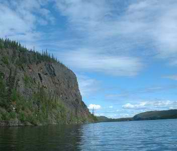
The next day we met for lunch.  She pulled out her chart and I pulled out the topos.  We agreed on a tentative plan that will have us spending time in both Christie Bay and McLeod Bay as well as doing an interesting portage out of Wildbread Bay to access Christie Bay.  The route will give us plenty of options and a varied land and water environment.

It is a bit old-fashioned in the day of Google Earth and GPS units to be fiddling around with hard copy charts and maps.  Yet, it is great to pat down a map and have the whole sweep of possibilities laid out before you.  We measured and discussed and reached a good realization that neither of us has any goal (e.g., minimum mileage) or destination (e.g., Fort Reliance at the end of the East Arm) of overriding importance.  This absence of burning ambition is important from a risk management perspective because it means we (hopefully) will be a bit less inclined to take undue paddling risks.

I learned my lesson in Georgian Bay when it comes to letting ambition override good common sense.  I have no desire to repeat the experience in the GSL.  Yet, I doubt that anyone will think we are lollygaggers.  I expect that we will cover a fair number of miles and push ourselves a bit to explore the new (to us) GSL environment.  It is a bit strange for me--and I speak only for myself--to be planning a trip where the primary goal is to be in the place rather than meet some arbitrary goal--e.g., complete a circumnavigation or cover X miles of coastline.

Sarah wants to take an ACA Instructors Certification Exam that has been scheduled for Labor Day.  We had tentatively hoped to end our GSL adventure that same weekend.  Either the ICE will be rescheduled or we will move up our trip.  Pushing up the dates means warmer weather, more daylight. . . and more bugs.

Hopefully, the issue of dates will be resolved soon.  We'll then reach out to our outfitter and local airline to lock in boats, lodging and flights to and from the East Arm.  We can then turn our attention to planning how to live and paddle safely and well for two weeks on wilderness water.